Cookie Settings
close

By clicking "Accept", you agree to the storage of cookies on your device to improve site navigation, analyze site usage and assist with our marketing efforts. See our privacy policy for more information.

Replica Road Closure Scenarios

Road Closure Scenarios allow users to simulate traffic patterns with custom road closures in order to understand the impact on travel behavior and the network. Unlike traditional models, this fully self-service approach enables rapid, efficient, and iterative forecast planning.

To celebrate the upcoming release of Replica’s Road Closure Scenario application, we’re going to select two organizations and run a free road closure scenario of their choice. Replica will run the selected scenarios, share the results with you and your org, and feature the use cases in an upcoming blog post. We’re excited to build a library of examples that demonstrate the power of this new tool.

Every organization that submits a use case, whether they are selected for the free scenarios or not, will receive promotional pricing for the Road Closure application. If you’d like the chance to have your scenario selected and to automatically receive promotional pricing, please submit a use case by EOD Wednesday, April 10th.

We’ll share the selected scenarios on April 12th and will share the blog post with results on April 22nd.

Fill out the form to submit a scenario:

Thank you! A team member will reach out shortly! 
Oops! Something went wrong while submitting the form.

Enter to Win an Active Transportation Planner Analysis

To celebrate Replica’s newest application, the Active Transportation Planner, we’re going to generate a complimentary Active Transportation analysis for two organizations! Replica will run the selected project within the app and deliver a view-only report that demonstrates questions the app can help you answer. This is an exciting opportunity to discover how your organization can leverage the Active Transportation application to understand the impact of active transportation projects in your region.


To enter your project into the drawing for a complimentary Active Transportation Planner analysis, please submit your use case by EOD on Thursday, August 29th. We’ll share the selected projects the following week, and outputs will be shared with the organizations by September 19th.

Thank you! A team member will reach out shortly! 
Oops! Something went wrong while submitting the form.

About the Active Transportation Planner

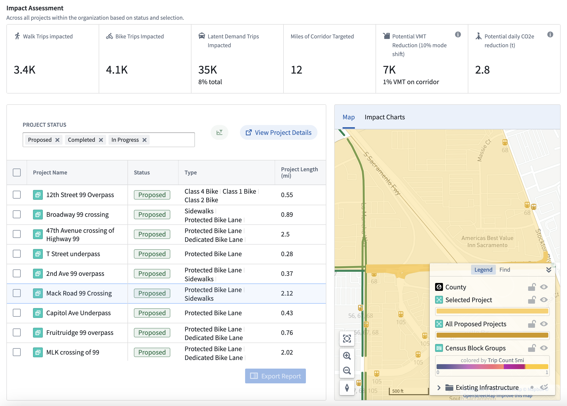
Create safer, more efficient active transportation networks in your zones of interest. By integrating metrics such as pedestrian and cyclist traffic, route preferences, and demographic patterns, this application enables agencies to identify potential growth corridors and optimize planning efforts. With the ability to compare performance across various projects, you can prioritize investments in infrastructure that will best serve community needs and enhance overall mobility.

Analyses Replica Enables

With Replica data, it's possible to answer new questions about scenario planning

Large-Scale and Small-Scale Event Planning

Major Infrastructure Updates

Safety and
Construction Planning

Emergency Planning and Preparedness